Geo-Informational System “Places of Mass Burials of the Holodomor Victims”
2018 - present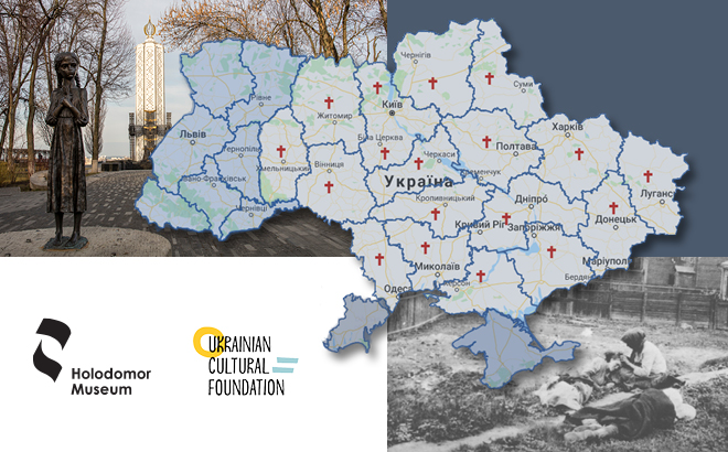
Project objectives
To collect information on the places of mass burial of the Holodomor victims and display it in the form of a geo-informational system.
Project description
The Holodomor of 1932-1933, genocide of the Ukrainian nation, killed more than 7 million people, but there is still a lack of information about the places of mass burials of its victims. Denying the very fact of the Holodomor in Ukraine, the occupying communist regime carefully covered the mass graves of genocide victims. For this purpose, city parks of culture and recreation were arranged at burials, enterprises were built, and roads were laid there. Areas in rural cemeteries were unattended; shrubs and grass grew over them, but those who survived always remembered their existence. It was their memories and archival materials that became the basis for filling the geo-informational system.
The portal provides a quick search for the burial places of the Holodomor victims by the name of the settlement, district or region. For each burial, the portal provides data on the number of buried victims, a photograph, the total number of Holodomor victims in this locality and other information.
In addition, the site contains a map of the administrative structure of the USSR (1933) and a modern map of Ukraine (2018), so it is possible to trace the affiliation of the settlement to the district and region accordingly to both contemporary administrative-territorial system and administrative system of 1933.
Project outcomes
During project implementation, 921 places of mass burials of the Holodomor victims were added to the site. In addition, many burials have been included in the national commemoration system, and commemorative events are held there nowadays.