Interactive GULAG Map
2017 - 2019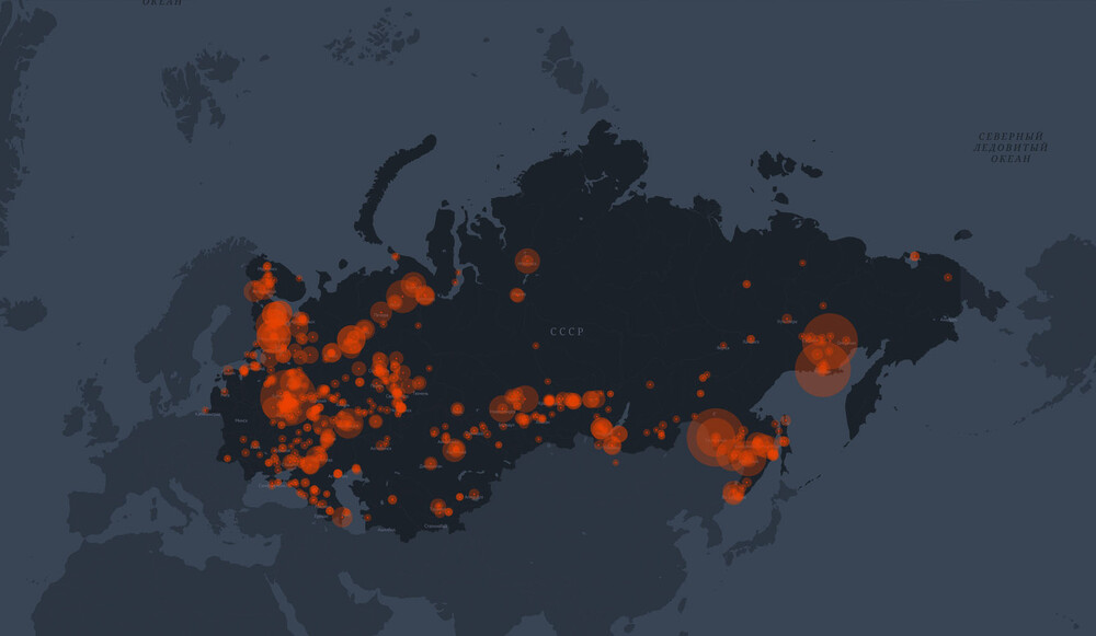
Project objectives
Interactive GULAG map is a visual representation of the Soviet camp system history. It is a permanently updated database on the history and geography of the forced labor camps that operated in the USSR from 1918 to 1960. The map has been created by the GULAG History Museum.
Project description
The project shows the scale of the Soviet punitive system whose prison camps were scattered across the entire country - from the Baltic Sea and the Crimea to Chukotka. The map shows the birth and evolution of this phenomenon, its climax in the times of the Great Patriotic War, and the eventual decline in 1960.
The majority of the GULAG camps had their production specialization. They were involved in agriculture, foresting, mineral production, building factories, railroads, and other facilities. In some labor camps, criminals lived side by side with political prisoners while others, the so-called “special camps,” were intended exclusively for the incarceration of inmates convicted under the 58th article of the RSFSR Criminal Code.
The map shows corrective labor, special, screening and filtration camps. Touching the red spot on the map will pop up a window containing geographic, historical and economic information about each camp. At the moment, the map represents over 550 camp locations on the terrotory of the USSR and beyond.
Project outcomes
In the future, the project aims to add first camps in the RSFSR and NKVD special purpose camps in East Germany, children’s colonies and a section about ethnic deportations and the exiling of kulaks. Moreover, the map will be updated with photographs, documents, and biographies of famous prisoners.
GULAG History Museum invites historians from Russian regions to collaborate and welcomes any information about the camps and their units. Of primary interest are cartographic materials, photo albums of the NKVD and USSR's Interior Ministry, statistical information, materials from regional archives and museums, as well as modern photographs of “GULAG traces”, which will be added as reference information to the interactive map.
If you have any information, please, contact gulagmap@gmig.ru